Wonderful World of Water program held in Pierce

The 33rd annual Wonderful World of Water Festival was held September 21 at Gilman Park in Pierce.  Fourteen teams of ninth and tenth grade students from 7 schools across Northeast Nebraska descended upon the park for a day of outdoor hands-on activities and a chance to compete for championship honors. 

The day began with registration at Gilman Park followed by the teams competing in a track of hands-on activities focusing on water quality and other natural resources related issues.  The teams were then quizzed regarding those sessions to accumulate points for the competition.  Following the educational sessions, the teams were given one last chance to extend their point totals by participating in the Dripial Pursuit Trivia Game.  Then while the final totals were being calculated each team was given the opportunity to participate in the Wonderful World of Water special project.

The special project was Water Rockets, which is, a program taught through the Jr. Academy of Sciences.  Each school was invited to build water rockets and demonstrate their knowledge of mass, velocity and engineering.  The rockets were judged on distance and creativity.  Several rockets were launched Wednesday with Allen High School first for Farthest Distance Traveled; Wausa High School recognized for Shortest Distance Traveled; and, Pierce High School Team 2 with the Most Creative Design.   

Following the presentation of the special projects, the winners of the 2022 Northeast Nebraska Wonderful World of Water were announced.  The winner of Track 1 was Pierce High School Team 1 consisting of Skylar Scholting, Elijah Streff, Aubrey Hanson, Natalie Kosch and Taydym Koch.  The winning team from Track 2 was Pope John High School Team 2 consisting of Quinn Hoefer, Harlie Tyler, Tessa Barlow, Camy Kittelson, Reese Stuhr, Jovie Vaisvllas, Haley Parks and Stephanie Gutierrez.  Both First Place teams were awarded Wonderful World of Water T-shirts.   

Schools participating in this year’s event included; Niobrara High School, Pierce High School, Elgin High School, Wausa High School, Allen High School, Norfolk Catholic High School and Pope John High School. 

The Wonderful World of Water program would not be possible without our many natural resources professionals from across the area who volunteer their time each year to share their expertise; and, work with students who might be interested in a career related to natural resources.  They come from a variety of agencies including:  The Natural Resources Conservation Service; UNL Nebraska Extension; Nebraska Game and Parks; Papio-Missouri River NRD; Upper Elkhorn NRD, Lewis & Clark NRD, Lower Niobrara NRD and, Lower Elkhorn NRD.  The Wonderful World of Water was sponsored this year by:  the Upper Elkhorn NRD; Lower Elkhorn NRD; Lower Niobrara NRD; and, Lewis and Clark NRD.

The winner of Track 1 was Pierce High School Team 1 consisting of Skylar Scholting, Elijah Streff, Aubrey Hanson, Natalie Kosch and Taydym Koch.

The winning team from Track 2 was Pope John High School Team 2 consisting of Quinn Hoefer, Harlie Tyler, Tessa Barlow, Camy Kittelson, Reese Stuhr, Jovie Vaisvllas, Haley Parks and Stephanie Gutierrez.

Water conservation is urgently needed as the drought intensifies

The impacts of the drought are becoming even more serious for the citizens of northeast Nebraska as the dry conditions continue to escalate.  The attached map shows the comparison across the Lower Elkhorn Natural Resources District (LENRD) over the last few weeks, with most of the district moving from an extreme drought to an exceptional drought (D4) designation.

During the drought of 2012, many private well owners found themselves lowering their pumps to provide water in their homes for their families.  Not only did domestic wells suffer, but there were also irrigation and livestock wells that failed to function properly during the drought.

LENRD general manager, Mike Sousek, said, “Imagine coming home after work to find you have no water in your home.  Or you turn on your pivot to water your crops and there’s no pressure, or your livestock well runs dry.  These are the times we are in, and we must come together, collectively, to protect the resource that we all share.”

An exceptional drought is a critical situation, and water conservation is at utmost importance.  The average person uses 80-100 gallons of water each day.  Sousek said, “We can all use at least 20 percent less water by being more mindful of our actions, checking for leaks, installing water-saving appliances, and managing our sprinklers more efficiently.”  Cities and towns across the district have water conservation measures in place, encouraging residents to limit their water use on their scheduled days.

Farmers are also bound to certain power restrictions limiting their usage during scheduled times throughout the irrigation season.  Economics also play a large role in limiting water usage.  Sousek added, “Even with restrictions in place, we can all work harder, as individuals, to do our part in protecting the resource.  We can’t wait for the cities to tell us when to conserve or wait until our well fails and we can’t pump water for our crops, we need to save water today and prepare for what happens next, if conditions don’t improve.”

To keep groundwater levels stable and protect supplies long-term, the LENRD has allocations in place for any irrigation wells installed after 2017.  Sousek said, “We would like to remind landowners, with newer wells, to plan accordingly with their irrigation scheduling and to be aware of the current 9-acre inch allocations.  All water users need to be cognizant of the amount of water being used and be accountable to our neighbors by assuring them that we’re doing all we can to share the resource with everyone around us, especially during a drought.”

There are also allocations in the Groundwater Quantity Management Subareas across the district.  In those areas, an additional 2-acre inches are available, after September 15th, for producers who are planting a cover crop.  Sousek said, “If someone abuses this allocation, it’s not only hurting the producer, but it’s hurting all groundwater users who share the resource and could affect future management decisions by the board.”

The drought is being closely monitored by the district, with possible drought mitigation actions being considered.   These actions will be determined by the board of directors and the district’s Drought Mitigation Response Team.  Any actions the district puts into place for the 2023 growing season must be decided by Nov. 1st.

Sousek added, “It’s important to adopt the mindset that the current dry cycle could be part of a multi-year weather pattern.  There’s value in preparing ourselves for what’s ahead and conserving our groundwater to help resolve present and future water quantity issues, to protect all groundwater users.”

The next LENRD board of directors meeting will be Thursday, September 22 at the LENRD office in Norfolk at 7:30 p.m. and on Facebook Live.

The Unrelenting Summer of 2022

By:  Brian Bruckner, LENRD Assistant Manager

Drought is an insidious, slow-onset natural hazard that produces a complex web of impacts that ripple through many sectors of the economy, and unfortunately, we are witnessing many of the negative impacts right in our own backyard.  The unrelenting heat and lack of precipitation are withering crops and pastures, causing heat stress for livestock and humans alike, and causing many communities to enforce watering restrictions to force conservation of groundwater. The spike in demand from all groundwater users is also taking its toll, with many well owners reporting a decline in the performance of their well, causing many to lower their pumps deeper into the well casing if they have the option.  A seasonal decline in static water levels is typical with the onset of irrigation season, but conditions this summer tend to parallel those created during the acute drought that occurred in 2012.  Many observation wells in the Lower Elkhorn Natural Resources District (LENRD) suffered record declines in depths to groundwater after that event, and many are curious to compare impacts to groundwater supplies once monitoring data has been collected following the 2022 pumping season.

In 2018, the LENRD added a provision into its groundwater management plan that provides guidance towards steering a meaningful response to drought impacts, with a graduated menu of options dependent upon the severity of the drought.  This provision utilizes the U.S. Drought Monitor, and the weekly maps that are created to illustrate the current drought designation, as the basis for providing information or activities that could be implemented to protect groundwater supplies.  A refined map is released on Thursday of each week and the most recent version shows that approximately 45 percent of the LENRD is currently situated in an extreme drought, or D3 designation.  As illustrated by the week-to-week comparison maps, the extreme drought area grew, though at a slower rate than the week prior.

A weather front brought rain showers to portions of the area earlier in the week, but amounts were not significant and geographic coverage spotty and therefore the drought stress continues.  Year-to-date precipitation for Norfolk, NE is currently at 10.72”, and is the lowest amount of annual accumulated precipitation ever recorded for this location, with records dating back to 1894.  By comparison, the annual accumulated precipitation for this station was 11.80” for the same date in 2012, another year that presented numerous drought related challenges for the region.

The topic has been at the forefront of discussions between the LENRD Board of Directors and staff, given the district’s responsibility to manage groundwater supplies.  All high-capacity wells are equipped with flow meters to measure the total flow and annual amount pumped, and some irrigation wells in the district are annually limited on the total amount that can be pumped for irrigation purposes.  Limits on these wells have been imposed for one specific reason; that being the need to protect existing groundwater uses while continuing to allow for new and/or expanded uses in some portions of the LENRD.  Some well owners are approaching the annual cap that is in place for their well, and many utilize sophisticated tools to help them manage their irrigation scheduling.  But given the lack of timely rainfall in many portions of the district the demand for supplemental irrigation is likely to continue until the crop reaches maturity. 

In preparation for the future, a group comprised of board members has been designated by the Chairman of the LENRD Board of Directors to serve on the Ad Hoc Drought Response Committee.  This committee will be tasked with closely monitoring pertinent pieces of information related to the drought and groundwater supplies.  Though the future is unpredictable, the current pattern of deficit precipitation is likely to continue, and the ad hoc committee will be working on options that could be enacted by the board of directors if the negative conditions continue.  Even if precipitation patterns return to normal, groundwater recharge may lag in some areas and an enhanced frequency of groundwater monitoring is ready to be implemented to provide scientific information as the basis for groundwater management decisions.

Most Nebraskans understand that drought it not uncommon to our region and given the dry and windy conditions we experienced earlier this year, most of us saw this coming.  While we hope the future holds a wetter pattern, we also recognize that the drought could very well extend into the next year, and maybe even beyond.  Some researchers are describing the dry conditions in western U.S. as the driest in 1,200 years.  Though our current situation isn’t comparable to that in the west, the time for proactive measures is upon us to ensure that the long-term viability of the groundwater resource can be protected for the future.

Public Open House slated for August 18th for Battle Creek Watershed Plan

The Lower Elkhorn Natural Resources District (LENRD) and Natural Resources Conservation Service (NRCS) will hold a public open house to provide an update on the Battle Creek Watershed Flood Risk Reduction Plan. The meeting will be held on Thursday, August 18, 2022, from 5:00 to 7:00 p.m. at the Battle Creek Community Clubhouse, 804 South 2nd Street in Battle Creek. All are welcome to attend and provide comments or questions to the project team. The meeting will be an open house event, with a short presentation at 5:00.  Attendees are welcome to drop-in anytime between 5:00 and 7:00 p.m.

This public meeting will provide an update on the planning process and review the proposed flood mitigation alternative within the Battle Creek Watershed, which spans more than 57,000 acres in Madison and Boone counties. During the public meeting, attendees will be able to learn more from project personnel, as well as ask questions and provide feedback.

Since beginning the planning process in 2020, the team has developed hydrologic and hydraulic models to show existing flooding conditions, reviewed various flood risk reduction alternatives, and have started drafting the watershed plan and environmental assessment. Current planning efforts are being led by JEO Consulting Group and will be completed by spring 2023.

The Battle Creek watershed has a long history of flooding, dating back to the 1940s, causing extensive damages and disrupting the economy of the region. Major flooding events throughout the 2000s, including Nebraska’s historical flooding event in 2019, has resulted in extensive damage worth millions of dollars. Following the catastrophic March 2019 flooding, the LENRD applied for Watershed Flood Prevention & Operations (WFPO) program funding from the NRCS, with a focus on mitigating flooding impacts within and near the City of Battle Creek.

As part of the WFPO program, the LENRD will work with the NRCS to develop the Battle Creek Watershed Work Plan – Environmental Assessment (Plan-EA). The Plan-EA will be used to help document existing problems, evaluate alternative, and identify a preferred alternative for future federal funding. 

The Plan-EA is being prepared to fulfill National Environmental Policy Act (NEPA) responsibilities pertaining to federal financial assistance received through the NRCS’s WFPO Program. Part of this project includes an evaluation of environmental resources and impact considerations, and all information gathered during the public meeting will help guide the planning process. 

For more information, please contact Curt Becker, Projects Manager for the LENRD, at 402-371-7313 or cbecker@lenrd.org

Assistance available for Nebraska farmers and ranchers impacted by wildfire

The U.S. Department of Agriculture’s Natural Resources Conservation Service (NRCS) has funding available to assist agricultural producers whose land was impacted by recent wildfires. Landowners have until August 19 to apply.

Through the Environmental Quality Incentives Program (EQIP) funding is available to help producers plan and implement conservation practices on farms and ranches impacted by natural disasters. EQIP funding is available to assist in this wildfire recovery effort by planting cover crops on impacted cropland and to defer grazing on rangeland.

“Numerous fires have impacted farmers and ranchers across Nebraska leaving ground vulnerable to erosion,” said Rob Lawson, state conservationist for NRCS. “We can assist landowners with installing conservation practices to help prevent any further damage to their agricultural land and aid in the recovery of rangeland productivity and soil health.”

Lawson encourages landowners whose agricultural operations were impacted by wildfire to visit their local NRCS field office.

“NRCS can help with recovery efforts,” Lawson said. “Our staff works one-on-one with landowners to assess the damage and develop approaches that lead to an effective recovery of the land.”

The application signup for this wildfire assistance is happening now and will run through August 19, 2022. Applications will be assessed, and even though some lands may be eligible for assistance, it is not guaranteed that all acres will receive financial assistance due to limited funding.

Interested landowners and operators should contact their local NRCS office in the USDA Service Center for applications and more information.

Groundbreaking held for Riverfront Project

By Nick Stevenson, City of Norfolk - Communications Manager

A groundbreaking ceremony was held Tuesday morning in Johnson Park, officially recognizing the beginning of the North Fork Riverfront Project after six years of planning and fundraising.

At its core, the North Fork River Restoration project includes the removal of a 6’ drop structure and a 6’ spillway at the bridge on First Street and the incorporation of eight, 18” drop points between the railroad bridge and the take-out point immediately south of the newly, redeveloped Norfolk Avenue bridge. The drop points will introduce white water characteristics to the river, provide beautification along the bank corridors, and enhance aquatic habitat including fish passages at each drop restoring the ability for fish to easily move upstream.

“One of the largest quality-of-life investments in Norfolk’s history, this project reenergizes the very place that first gave life to our community, utilizes our natural resources to promote outdoor recreation and tourism, and acts as a catalyst to private reinvestment that is already transforming downtown Norfolk into one of the state’s most unique, vibrant mixed-use environments,” said Norfolk Mayor Josh Moenning. 

The Johnson Park revitalization plan focuses on the rehabilitation of a park that was once considered an integral part of Norfolk’s economic and cultural identity. The plan includes varying degrees of grading to provide safe, ADA access to the river, introduces additional parking, provides for enhanced festival space, and cultivates the expansion of youth amenities. The introduction of an amphitheater with a permanent stage and grass seating for hundreds will establish another unique, outdoor venue for concerts, plays, and ceremonies in Norfolk.

“What we’re trying to do is attract young people that live in communities throughout Northeast Nebraska, to give them an option to come to Norfolk and start their career in the hopes that they’re able to move back to the family farm and raise their grandkids in Randolph, in Neligh, in Wayne, and in Humphrey. This is bigger than Norfolk this is about the area. Norfolk is investing in our core, we are putting money to the place that our community started,” said Nebraska First District Congressman Mike Flood. 

The project is being funded by a combination of grant resources, keno funds, and private sector donations.

Left to Right: Traci Jeffrey, Executive Director of Norfolk Area Visitors Bureau, Andy Colvin, Norfolk City Administrator, Steve Rames, Norfolk Public Works Director, Lt Governor Mike Foley, Darrel Novacek, Riverfront Fundraising Committee Member,. Angie Stenger, Executive Director of Growing Together, Joe Ferguson, Riverfront Fundraising Committee Member, Mayor Josh Moenning, Nebraska First District Congressman Mike Flood, Mike Sousek, General Manager of the Lower Elkhorn Natural Resources District, Jason Love, Riverfront Fundraising Committee Chair, & Nathan Powell, Norfolk Parks and Recreation Director.

Signup for irrigated acres 'on hold' due to drought conditions

As the drought continues to intensify across the Lower Elkhorn Natural Resources District (LENRD), some landowners are experiencing fluctuations in their well pressure.

At their July meeting, the LENRD board postponed the discussion about a new irrigated acre signup until a later date and directed staff to continue to monitor the drought and groundwater levels.

Brian Bruckner, LENRD Assistant Manager, said, “We are already receiving calls about pumping conflicts, with several weeks left in the irrigation season.  I think it would be irresponsible for us to move forward with scheduling a signup period during the current drought conditions.”

If the drought persists, the board will make any necessary decisions about 2023 water restrictions by November 1st.

The discussion of the Battle Creek Watershed Plan was also on the agenda.  Several members from the public voiced their desire for more information about other options to reduce flooding in the watershed.  There will be a Public Open House for the Battle Creek Watershed Flood Risk Reduction Plan on Thursday, August 18th from 5:00 p.m. to 7:00 p.m. at the Battle Creek Community Clubhouse at 804 South 2nd Street.  This open house will allow the public the opportunity to review the information from the recent study by JEO Consulting Group.  The project team will be available for questions.

In other business, the board accepted the low bid from Pruss Excavation, of Dodge, for the Scribner streambank repair project on the Elkhorn River in the amount of $131,334.  This project will be cost-shared with Dodge County, the City of Scribner, the Federal Emergency Management Agency, the Nebraska Emergency Management Agency, and the LENRD.

The next LENRD committee of the whole meeting will be held Thursday, August 11th at 7:00 p.m. with the board meeting to follow on Thursday, August 25th at 7:30 p.m.  Watch for further updates and stay connected by subscribing to monthly emails at lenrd.org.

$1.032 million presented to the City of Norfolk to revitalize riverfront

Imagine floating peacefully down a lazy river with family and friends, then drifting into a downtown area where great food, shopping, and live music await.  It’s a dream that is coming true for people in and around Norfolk who have raised millions in grants and matching funds to transform the city’s downtown riverfront district into one of the finest tourism destinations in northeast Nebraska.

Several board members and staff for the Lower Elkhorn Natural Resources District (LENRD) presented a check to the city Thursday, July 14th at 5:00 p.m. near the project site on First Street.  The LENRD board of directors made the decision to support the project in 2018 when they voted to provide $1.032 million to the North Fork Riverfront Development Project.

Mike Sousek, LENRD general manager, said, “The plan to develop the Norfolk riverfront is nothing new to this district.  The first stages of the original project were studied by the city and the LENRD in 1974.  Over the past 10 years, the study has found new life and is finally becoming a reality.”

This long-term vision set in place almost 50 years ago has exploded with dreams of restaurants, new business locations, housing, bike lanes, and more.  The original “riverwalk group” as they were sometimes called, pictured the river walk in San Antonio, and have scaled it to fit the needs of the Norfolk Area.  Norfolk Mayor Josh Moenning, the North Fork Development Committee, and other local leaders have envisioned the area being used to generate new cultural and recreational opportunities, providing a regional destination for working, playing, and living environments.

Sousek said, “The river is a natural resource with a rich history that should be protected and utilized for the benefit of the local area.  Maintaining strong community partnerships over the years have increased our success in the development of recreational facilities as well as our mission for improving the quality of life for our citizens.”

The North Fork Riverfront Development Project will be home to a water trail that will allow tubers and kayakers to access the river and float directly to the heart of downtown.  Other extensive park improvements, walking and biking trails, and an outdoor amphitheater are also planned.

Water quality will be another large component of this regional partnership.  The LENRD awarded Norfolk Public Schools with a grant to start a Watershed Dynamics Program.  Jonathan Anderson, FFA Advisor with Norfolk Public Schools, along with their science and agriculture departments, are teaming up to partner with the City of Norfolk and the LENRD to collect data and analyze the water quality of the Elkhorn River.  The Watershed Team will focus on three locations on the North Fork of the Elkhorn River and will collect samples at different times of the year to help with analysis.

Sousek added, “The LENRD’s investment in the riverfront development project is about building an environment that will bring people back to northeast Nebraska.  The economic benefits that this project will have for this area will be monumental and we’re excited to be a part of it.”

LENRD General Manager Mike Sousek presents City of Norfolk Mayor Josh Moenning with a check in the amount of $1.032 million for the North Fork Riverfront Development Project.

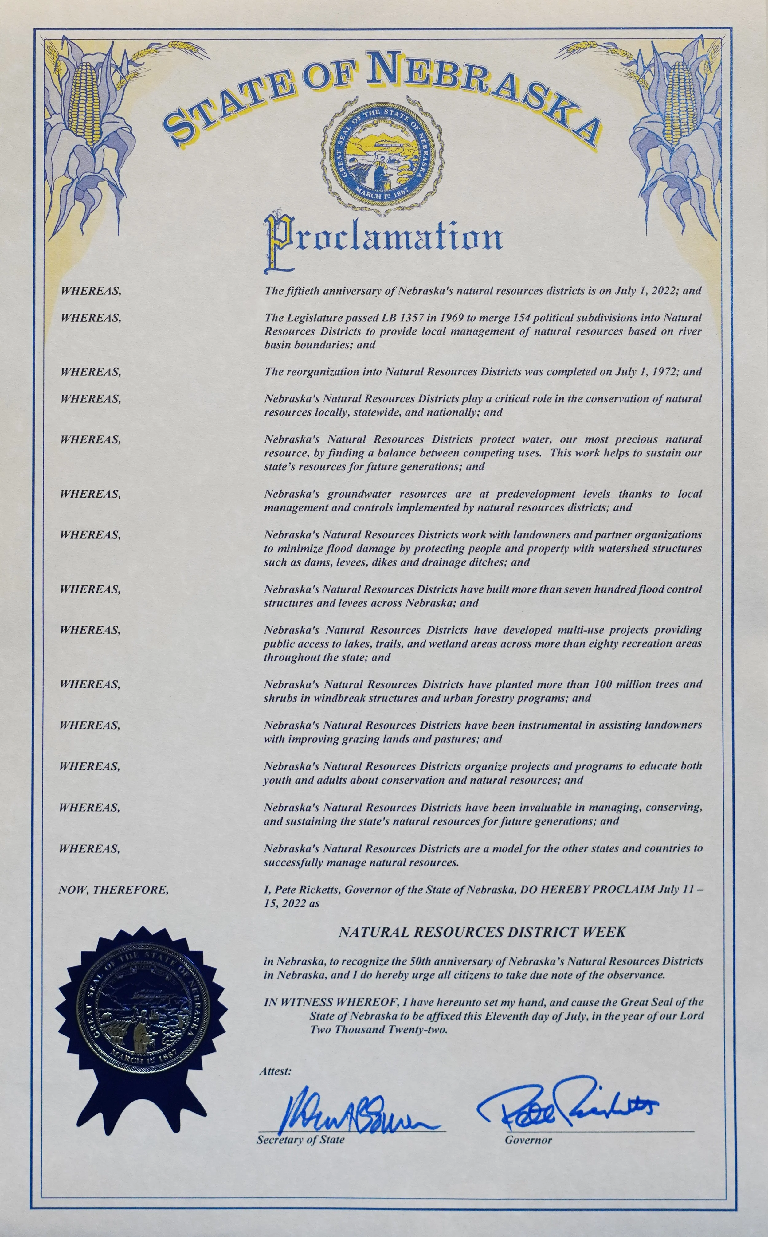
Governor Ricketts Proclaims July 11-15 as NRD Week

The Nebraska Association of Resources Districts (NARD) Executive Committee make NRD Week (July 11-15, 2022) official with a proclamation from Gov. Pete Ricketts. From left, NARD Past President Jim Eschliman (Lower Loup NRD), NARD Executive Director Dean Edson, NARD President Dr. Orval Gigstad (Nemaha NRD), NARD Secretary/Treasurer Joel Hansen (Lower Elkhorn NRD), and NARD Vice President Martin Graff (Middle Niobrara NRD).

LINCOLN, Nebraska – With the swoosh of a pen and eager applause, Gov. Pete Ricketts proclaims July 11-15, 2022, as NRD Week in Nebraska to celebrate Nebraska’s Natural Resources Districts (NRDs) 50th anniversary.

“We are proud to celebrate five decades of protecting, conserving and improving Nebraska’s nature resources,” said Dr. Orval Gigstad, Nebraska Association of Resources Districts president. “It’s amazing to see the conservation progress that has been made these last 50 years and NRD directors and staff know the work we do today – planting trees, water management, soil health – will directly impact our future.”

After the devastation of the Dust Bowl, special purpose districts were developed to solve local soil and water-related problems. But the puzzle of overlapping authorities and responsibilities provided confusion at best.

In 1969, Senator Maurice Kremer introduced legislative bill 1357 to combine Nebraska’s 154 special purpose entities into 24 Natural Resources Districts by July 1972. In 1989, The Middle Missouri Tributaries NRD and the Papio NRD merged to become the Papio-Missouri River NRD resulting in today’s 23 Natural Resources Districts.

Today, Nebraska’s unique system of locally controlled, watershed-based conservation is widely admired throughout the nation.

NRDs deliver several state and federal programs including many projects with the U.S. Department of Agriculture Natural Resources Conservation Service (NRCS), Nebraska Department of Environment and Energy (NDEE), Nebraska Department of Natural Resources (NeDNR) and the University of Nebraska. These partnerships equate into real dollars for Nebraska agriculture and communities.

“Nebraska policymakers had incredible foresight when creating the NRDs realizing that our strength lies in collaboration with partners to champion conservation,” Dr. Gigstad said. “Our partnerships with local, state and federal agencies have helped deliver conservation to millions of acres reducing soil loss and improving water quality and quantity.”

Across the state, Natural Resources Districts construct projects, implement programs and aid landowners in conservation and natural resources management. When necessary, they enact regulations to protect our resources. While all NRDs share the 12 main responsibilities, each district sets its own priorities and develops its own programs to best serve and protect Nebraska’s natural resources. Often the most recognizable NRD responsibilities include groundwater management, flood protection and conservation trees.

Governor Rickets signs the proclamation.

Groundwater Management

Nebraska’s Natural Resources Districts are responsible for protecting one of our most precious resources – groundwater. This mean ensuring there is enough for all users and protecting it from pollution.

As the No. 1 irrigated state in the nation, managing Nebraska’s water to ensure there is enough for domestic, industrial and agricultural purposes is essential. NRDs work with irrigators to monitor water use, establish groundwater recharge projects, and implement water-wise programs. This is especially important during times of drought.

NRDs have been developing groundwater quality plans since the 1980s, which are an essential part of protecting our water. Addressing groundwater quality issues requires regular data collection and recognizing and planning for changing conditions. Regulatory and taxing authorities allow NRDs to develop locally based incentive and educational programming and to enforce regulations when needed to protect Nebraska’s groundwater today and into the future.

Flood Protection

From Gering Valley in the Nebraska Panhandle to Papillion Creek in the Omaha metro, NRDs across the state employ a watershed protection approach. Utilizing floodplain management measures, NRDs design and build dams, levees, dikes, drainage ditches and other structures to keep flood waters from taking lives or damaging crops, buildings and roads.

Flood control projects are developed for multiple purposes and often provide the additional benefit of recreation including activities such as boating, fishing, camping, wildlife viewing and pedestrian trails. Trails are built atop levees and flood-control reservoirs often develop into recreation areas. Habitat areas and wetlands are available for hunters and often preserved for interpretative nature study.

Conservation Tree Program

This spring, the NRD Conservation Tree Program planted its 100 millionth tree – that’s approximately 50 trees for each Nebraskan. Annually, the NRD Conservation Tree Program provides hundreds of thousands of low-cost, bulk trees and shrubs for windbreaks, erosion control, wildlife habitat and other conservation purposes. Districts collect orders for trees between November and March, then trees are distributed in April for spring planting. 

Natural Resources Districts’ staff and directors will plant the ceremonious 100 millionth tree on the Nebraska Capitol grounds in a public ceremony this fall.

Dr. Gigstad noted that Nebraska’s NRDs will continue to adapt to meet future conservation needs.

“Protecting our precious resources like soil and water is something we can all agree on,” he said. “NRDs are uniquely positioned to help manage our natural resources to protect lives, property and the future of Nebraska’s communities.” 

To join in the 50th anniversary celebration and follow the Natural Resources Districts’ special activities throughout 2022, visit www.nrdnet.org and follow #Since1972 on social media.

The Nebraska Association of Resources Districts (NARD), the trade association for Nebraska's 23 Natural Resources Districts (NRD), works with individual districts to protect lives, property and the future of Nebraska’s natural resources. NRDs are unique to Nebraska, and act as local government entities with broad responsibilities to protect Nebraska’s natural resources. Major Nebraska river basins form the boundaries of the 23 NRDs, enabling districts to respond to local conservation and resource management needs. Learn more about Nebraska’s NRDs at www.nrdnet.org.

LENRD is hiring an Office Assistant

The Lower Elkhorn NRD is hiring an Office Assistant. This position provides general administrative support involving a variety of specialized tasks, requiring independent decision-making. Work involves assisting walk-in traffic, answering phones, and daily clerical functions within the LENRD office. The assistant will also work with cooperating agencies and organizations in support of the NRD’s projects and programs. Clerical assistance will also be provided to the Nebraska Department of Natural Resources.

The successful candidate should possess social, organizational, and teamwork skills; have a working knowledge of Microsoft Office, and the ability to handle multiple tasks.

This position comes with an excellent benefits package. Review of resumes will begin July 22, 2022. Send to: Lower Elkhorn NRD, Attn: Mike Sousek, 1508 Square Turn Boulevard, Norfolk, NE 68701.

Position open for Communications Specialist

The Lower Elkhorn Natural Resources District (LENRD) has an immediate opening for a Communications Specialist. This position involves the independent preparation and distribution of information and related materials to educate the public about the LENRD’s projects, programs, goals, and policies.

Work involves preparing a wide variety of written informational materials including newsletter articles and news releases, fact sheets, posters, brochures, and display ads; coordinating audio and visual information; website development, and social media marketing. Consulting with individuals from government agencies, community organizations, and citizen advisory groups is also important.

The successful candidate should possess social, organizational, and teamwork skills; have a working knowledge of Adobe Creative Suites and Microsoft Office, and the ability to handle multiple tasks.

This position comes with an excellent benefits package. Review of resumes will begin July 22, 2022. Send to: Lower Elkhorn NRD, Attn: Mike Sousek, 1508 Square Turn Boulevard, Norfolk, NE 68701.

Nebraska's Natural Resources Districts celebrate 50 years of conservation

Once dismissed as ‘The Great American Desert,’ Nebraska is now known for its agricultural bounty and natural wonders.  Throughout 2022, Nebraska’s Natural Resources Districts (NRDs) are celebrating 50 years, commemorating breakthroughs, and achievements in conservation.

“The NRDs have faced many changes in the last 50 years, affecting the ways we protect our natural resources for the future,” said Mike Sousek, general manager for the Lower Elkhorn Natural Resources District (LENRD), which covers all or parts of 15-countes in northeast Nebraska.  Let’s look back at how the NRDs were first organized.

After the devastation of the Dust Bowl, special purpose districts were developed across the nation to solve local soil and water-related problems.  But the overlapping of authorities and responsibilities created some confusion, which sparked Nebraska legislators to form a new plan for their state.

In 1969, Senator Maurice Kremer introduced legislative bill 1357 to combine Nebraska’s 154 special purpose entities into 24 NRDs by July 1972. The 24 district boundaries were based on the river basins, allowing for better management practices to be applied to similar topography.  In 1989, The Middle Missouri Tributaries NRD and the Papio NRD merged to become the Papio-Missouri River NRD resulting in today’s 23 NRDs.

Legislative Signing: In 1969, the 80th Unicameral created the Natural Resources Districts (NRDs) with the passage of legislative bill 1357. From left, Chester Ellis, President of Nebraska Association of Soil and Water Conservation Districts; Sen. Maurice Kremer, Chairman of the Nebraska Legislature’s Agriculture and Recreation Committee; Gov. Norbert Tiemann; Warren Patefield, Immediate Past President of Nebraska Association of Soil and Water Conservation Districts; Milton Fricke, Director of the National Association of Soil and Water Conservation Districts; and Warren Fairchild, Executive Secretary of the Nebraska Soil and Water Conservation Commission.

While all NRDs share 12 main responsibilities, each district sets its own priorities and develops programs that best serve and protect their local area.  They are led by a locally elected Board of Directors, uniquely positioned right in their own communities.  Sousek said, “Funding for district projects and programs comes from leveraging collected property tax dollars to obtain grants, which account for nearly 50% of expenditures.  In most cases, your local NRD typically uses 1-2 percent of all property taxes collected in the district.”

Across the state, NRDs construct flood control projects, implement soil conservation programs, offer technical and financial assistance to landowners for natural resources management as well as forestry and recreational development.  When necessary, they enact regulations to protect our resources. 

Since being created in 1972, NRDs have experienced tremendous growth in the responsibilities given to them by state statute, especially in protecting groundwater.  Despite being the #1 irrigated state in the nation, Nebraska’s statewide groundwater levels have been sustained at levels less than a foot below the pre-irrigation development in the 1950s.  In some areas, groundwater levels are even higher.  Many states are facing massive groundwater declines with almost depleted aquifers.  Sousek said, “Nebraska’s NRDs work with irrigators to monitor water use, establish groundwater recharge projects, and implement water-wise programs.”

Groundwater quality is another responsibility of the NRDs.  In northeast Nebraska, the LENRD builds partnerships with various agencies and organizations to address water quality issues, including the USDA Natural Resources Conservation Service, the Nebraska Department of Natural Resources, other state and federal agencies, municipalities, counties, and private organizations.  “Nitrate levels are increasing across the state.  We are working together to identify measures used to preserve quality groundwater for the future,” said Sousek.  Visit our website www.nitrateinwater.org for more information.

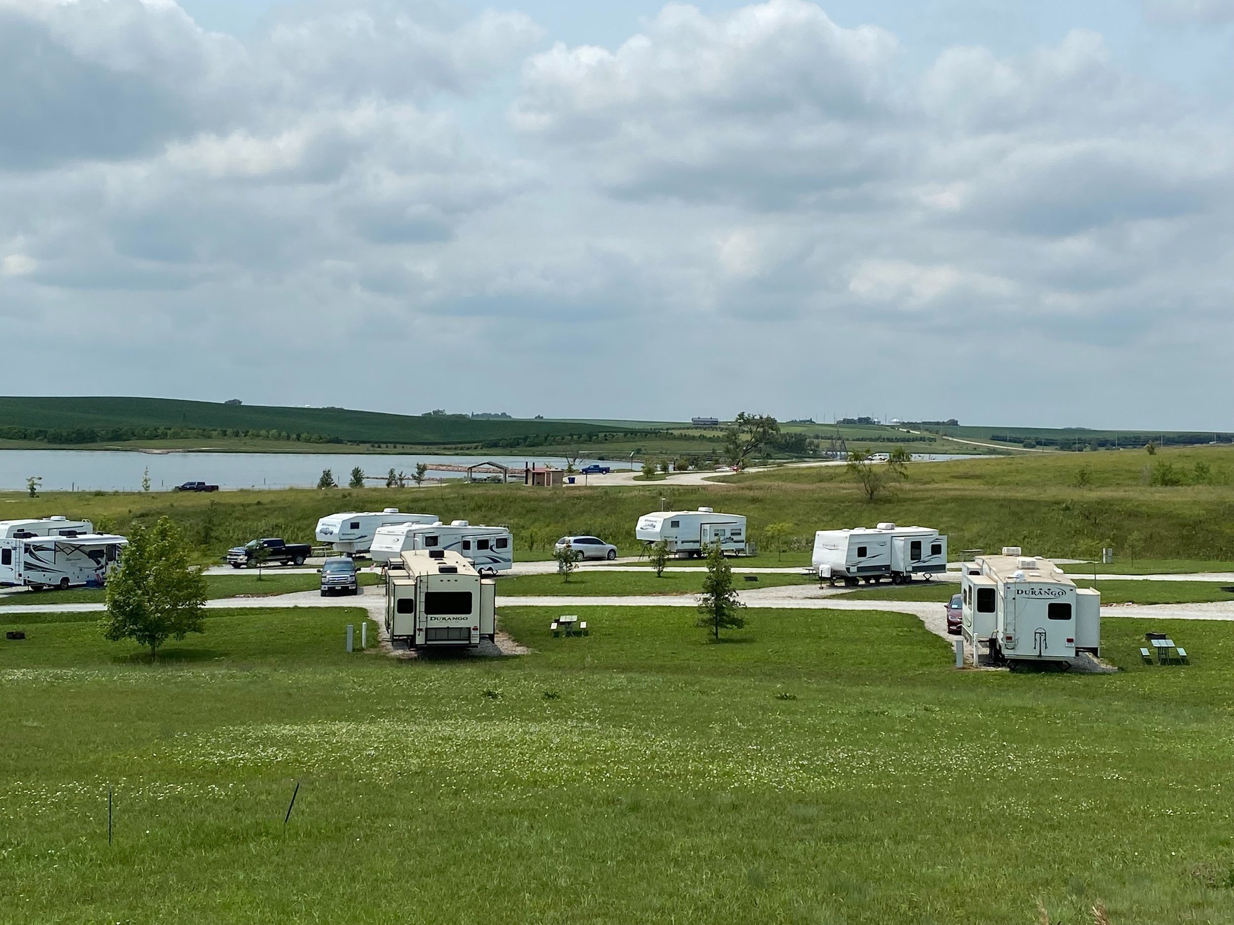
The LENRD’s major accomplishments over the past 50 years include multi-purpose structures across the district.  One of those is the Willow Creek State Recreation Area (SRA) just southwest of Pierce, NE.  This flood control dam protects landowners downstream on Willow Creek, to just north of Norfolk.  The dam held back over 18,000 acre-feet of water during the historic flood of 2019, totaling over 5.86 billion gallons, preventing monumental damages further downstream.  The area is owned by the LENRD but is managed by the Nebraska Game & Parks Commission as a state recreation area.  A park sticker is needed to enter the area, which boasts 124 campsites, half of which can be reserved at www.OutdoorNebraska.org 

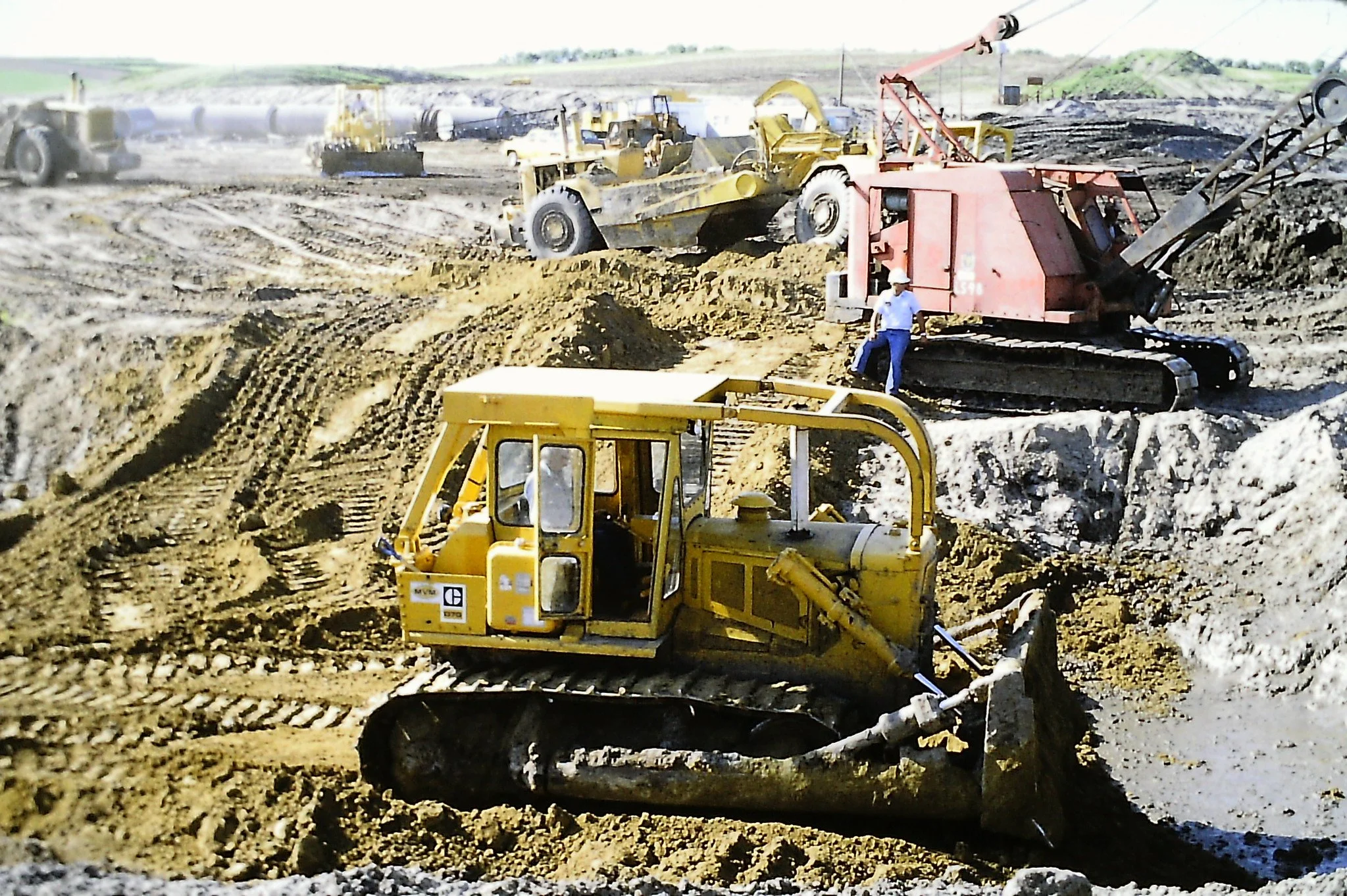
This photo shows the excavation of the Willow Creek SRA in the early 80’s.  The recreation area opened to the public 38 years ago in 1984.

The Logan East Rural Water System is another project administered by the LENRD.  This system is the largest of its kind in the state, providing quality water to approximately 1,200 customers in portions of Burt, Dodge, and Washington counties, including the villages of Herman, Uehling, and Winslow.  The system has 3 wells and 3 towers with over 600,000 gallons of water storage and 800 miles of pipeline to rural customers.  The office for the system is in Oakland, NE.  The advisory committee is currently looking to expand the system to provide quality water for other areas in need.

The Wau-Col Regional Water System is another large project owned by the LENRD.  This system provides quality water to the villages of Belden, Magnet, and McLean.  Water is purchased from Coleridge and sent to Belden, and water is purchased from Wausa and sent to 16 rural customers as well as Magnet and McLean.  The name “Wau-Col” is derived from Wausa-Coleridge.  The system travels across 3 county lines – Knox, Cedar, and Pierce Counties.  The $3.1 million project was made possible by a grant from the U.S. Department of Agriculture – Rural Development and area sponsors including the LENRD and the Lewis & Clark NRD.  The project was dedicated on August 11, 2012, at the tower site in Wausa, NE.

The Wau-Col Regional Water System tower in Wausa, Nebraska, is one of the tallest in the state at approximately 210 feet.

In the past 50 years, the LENRD has distributed over 4 million trees across its boundaries through the Conservation Tree Program.  Community Forestry and Urban Development programs also assist communities with tree planting and recreational projects.

Today, Nebraska’s unique system of locally controlled, watershed-based conservation is widely admired throughout the nation.  In recent years, at least 11 states have inquired about applying a similar system for natural resources management.

Sousek added, “After 50 years, Nebraska’s NRDs continue to adapt to the local needs of our communities to meet the challenges of today.  Join us at our Norfolk office for an Open House on July 13th to celebrate this milestone.”

The LENRD is hosting an Open House on Wednesday, July 13th at their office in Norfolk to celebrate their 50th Anniversary!  The day will begin with coffee at 10:00 a.m. with the Norfolk Area Chamber of Commerce.  The public is invited to stop by anytime between 10:00 a.m. and 5:30 p.m. for refreshments, giveaways, groundwater demonstrations, and more!  At 7:30 p.m. we will host our final “Stars, Strolls, & S’mores” event of the season at the Elkhorn Valley Museum and Verges Park.  Join us!

Original LB 1357: In 1969, Sen. Maurice Kremer introduced legislative bill 1357 to combine Nebraska’s 154 special purpose entities into 24 Natural Resources Districts by July 1972. In 1989, the Middle Missouri Tributaries NRD and the Papio NRD merged to become the Papio-Missouri River NRD resulting in today’s 23 Natural Resources Districts.

Lower Elkhorn NRD partners with Nebraska Game and Parks to repair flood damages at Willow Creek

A fisherman enjoying the restful waters of Willow Creek.

Even though the dam at the Willow Creek State Recreation Area (SRA), southwest of Pierce, did everything it was designed to do during the flood of 2019, damage to some areas of the recreation area were unavoidable.  The Lower Elkhorn Natural Resources District (LENRD) owns the recreation area and partners with the Nebraska Game and Parks Commission (NGPC) to manage the area as a State Park.

Mike Sousek, LENRD general manager, said, “This long-standing partnership is important to the district, and we want to work with Game and Parks to repair the area and keep access to quality recreation areas available for the public.”

 At their June meeting, the LENRD board members approved the interlocal agreement with the NGPC and the invoice to repair the flood damages at the Willow Creek SRA in the amount of $19,550.

The board also discussed the drilling of 2 relief wells to relieve the pressure at the dam site.  After 2 failed attempts with a local driller, the board authorized the general manager to negotiate with another driller to complete the work.

Sousek, said, “We will work as efficiently as possible with our tax dollars to get this project completed as quickly as we can.  During the irrigation season is the optimal time when the pressure is low.”

In other action, 3 motions recommended by the Logan East Rural Water System Advisory Board were passed.  The board approved the water rate increase of 5% starting on the January 2023 billing cards; approved the well #3 rehab to replace the casing liner, screens, and pumping parts; and agreed to draw up a purchase agreement for a one-acre site of land for a new pumping well, contingent on test well water samples and satisfactory aquifer formations.

The board also accepted the resolution and participation agreement for the employee retirement plans and approved the recommendation from the executive committee for the salary adjustments and step and grade changes for fiscal year 2023.

The next LENRD committee of the whole meeting will be held Thursday, July 14th at 7:00 p.m. with the board meeting to follow on Thursday, July 28th at 7:30 p.m.  Watch for further updates and stay connected with the LENRD by subscribing to their monthly emails at lenrd.org.

~STOP BY THE LENRD OFFICE IN NORFOLK ON WEDNESDAY, JULY 13 FOR AN OPEN HOUSE TO CELEBRATE THE 50TH ANNIVERSARY OF NEBRASKA’S NRDs ~PROTECTING LIVES, PROTECTING PROPERTY, PROTECTING THE FUTURE~

Protecting groundwater quality a priority for NRDs

LINCOLN, Nebraska – Since their inception in 1972, Nebraska’s Natural Resources Districts (NRDs) have been monitoring groundwater quality to protect lives, property and the future.

Approximately 85 percent of Nebraskans rely on groundwater as their drinking water source and it is the primary irrigation source for agriculture, Nebraska’s No. 1 industry. NRDs have been developing groundwater quality plans since the 1980s, which are an essential part of protecting Nebraska’s most precious resource.

Groundwater quality issues are often multi-faceted with no-one-size-fits-all solution, as highlighted in the following NRD programs.

Bazile Groundwater Management Area – Lewis & Clark, Lower Elkhorn, Lower Niobrara and Upper Elkhorn NRDs

Congressman Adrian Smith visit the Bazile Groundwater Management Area (BGMA) and City of Creighton Water Department to learn more about nitrate in groundwater. From left, Rep. Smith; Steve Morrill, Creighton Mayor; Annette Sudbeck, Lewis & Clark NRD general manager; Joslynn VanDerslice, Upper Elkhorn NRD water resources manager; Whitney Gappa, former BGMA coordinator; Terry Julesgard, Lower Niobrara NRD general manager; Lindsay Nelson, Creighton city administrator; Kevin Sonnichsen, Creighton water commissioner and fire chief; and Mike Sousek, Lower Elkhorn NRD general manager.

The Bazile Groundwater Management Area (BGMA) brings together ag producers, four NRDs, the Nebraska Department of Environment and Energy, the Natural Resources Conservation Service, the Nebraska Environmental Trust and Nebraska Extension to address rising nitrate levels in communities and domestic wells in northeast Nebraska.

The nitrate contamination goes beyond individual NRD borders and includes parts of three counties – Antelope, Knox and Pierce. Sandy soils, shallow depth to groundwater and extensive application of nitrogen fertilizer and irrigation water make the BGMA aquifer particularly vulnerable to nitrate contamination.

Agriculture producers in the BGMA work to reduce nonpoint source groundwater contamination through the adoption of best management practices (BMPs), which could include nitrogen inhibitors, soil sampling, water sampling, limits on fall fertilizer application, variable-rate applicators, center pivot irrigation, chemigation, flow meters, cover crops, moisture sensors, split feeding fertilizer, and factoring in the nitrogen present in the irrigation water when deciding fertilizer application.

One best management practice used to protect groundwater is chemigation. Chemigation is the injection of agricultural chemicals into water flowing through an irrigation distribution system for application to land, crops, or both. Using chemigation, producers can regulate the rate of application and chemicals may be applied at the exact time needed by plants. NRDs provide chemigation permits and regularly inspect the equipment to ensure it is in proper working order.

“Nonpoint source pollution is difficult to address, because the source of the problem is from a widespread area,” said Terry Julesgard, Lower Niobrara NRD general manager. “The success of the program relies on producers voluntarily utilizing the various tools and actively making changes to reduce contamination and improve groundwater quality.”

This voluntary, collaborative approach allows BGMA partners to leverage U.S. Environmental Protection Agency (EPA) Clean Water Act funding and make a stronger case for receiving federal funding to collectively address the problem in the larger aquifer. The BGMA Plan was the first federally recognized groundwater-focused plan to address nonpoint source pollution in the nation.

Hastings Wellhead Protection Area – Little Blue and Upper Big Blue NRDs

Central Platte NRD Manager Lyndon Vogt, center, and Lower Niobrara NRD Assistant Manager Wade Ellwanger, right, visit Hastings Utilities to learn about their unique process for treating the city’s drinking water, which has high nitrate levels.

A Wellhead Protection Area has public drinking water wells, which require special attention to prevent contamination. Through regular water testing, the City of Hastings found that several of their wells were above the allowable limit for nitrate contamination.

Since Hastings is split between two NRDs – Little Blue and Upper Big Blue – and because nonpoint source nitrate pollution is primarily from surrounding agricultural activity, the city coordinated with the districts. NRDs have regulatory authority and the necessary flexibility to develop the collaborative programming to help protect Hastings’ drinking water.

The Hastings Wellhead Protection Area program uses educational programming and producer incentives to reduce contamination. Cost-share programs include irrigation management, soil sampling, septic tank and leach field abandonment, and well abandonment.

“This project bridges the rural-urban divide to address nonpoint source nitrate pollution,” said David Eigenberg, Upper Big Blue NRD general manager. “Understanding the sources of contamination and preventing additional contamination is key. This partnership will require long-term cooperative efforts between producers and NRDs to slow nitrate losses to protect drinking water.”

Rain-Ready Landscapes Program – Lower Platte South NRD

Rain gardens capture runoff from hard surfaces like parking areas and driveways. The runoff filters into the surrounding soils, reducing the need for watering.

Groundwater contamination is not just a rural issue. Due to stormwater runoff, many pollutants typical in urban areas can be found in local waterways. Lower Platte South NRD offers cost share to homeowners, who participate in the Rain-Ready Landscapes Program in Lincoln and throughout the district.

The goal of this program is to improve water quality, reduce runoff, and facilitate infiltration by preventing water from leaving properties and entering storm drains. By installing landscaping projects like rain gardens or bioswales, waterwise lawns, and pavement removal, rainwater is slowed and captured to allow infiltration.

In addition to protecting water quality, rainscapes are more sustainable than traditional landscaping because they utilize native plants, which require less water and fewer pesticides. 

Addressing groundwater quality issues requires regular data collection and recognizing and planning for changing conditions. Nebraska’s Natural Resources Districts’ regulatory and taxing authorities allow NRDs to develop locally based incentive and educational programming and to enforce regulations when needed to protect Nebraska’s groundwater today and into the future.

Throughout 2022, the NRDs will commemorate breakthroughs and achievements in conservation. To join in the celebration and follow the Natural Resources Districts’ special activities throughout 2022, visit nrdnet.org and follow #Since1972 on social media.

The Nebraska Association of Resources Districts (NARD), the trade association for Nebraska's 23 Natural Resources Districts (NRD), works with individual districts to protect lives, property and the future of Nebraska’s natural resources. NRDs are unique to Nebraska, and act as local government entities with broad responsibilities to protect Nebraska’s natural resources. Major Nebraska river basins form the boundaries of the 23 NRDs, enabling districts to respond to local conservation and resource management needs. Learn more about Nebraska’s NRDs at www.nrdnet.org.

Recreational opportunities abound in northeast Nebraska

Planning to stay close to home this summer?  You’re never far from a public outdoor recreation area.  Many of these trails, lakes, parks, and wildlife areas are built and maintained by Nebraska’s Natural Resources Districts (NRDs).

If you’re reading this, it’s safe to say you probably live within the boundaries of the Lower Elkhorn Natural Resources District (LENRD) in northeast Nebraska.  As one of the 23 districts across the state, the LENRD has 12 responsibilities, from the State Legislature, to protect our natural resources.  One of these responsibilities includes the development and management of recreational and park facilities.

Most LENRD projects are developed for multiple purposes, often combining flood control structures with recreation, wildlife habitat enhancement, soil erosion and sediment control, or wetland renovation along rivers and streams.

In the LENRD, there are 3 recreation areas waiting for you to enjoy!  The Maskenthine Project was constructed by the LENRD in 1975-76 for flood control and recreation.  It was the first major flood control project in the Elkhorn River Basin and the first to receive a grant from the Nebraska Natural Resources Commission Water Development Fund.  The 100-surface acre lake filled rapidly with snow melt and early spring rains and was opened to the public in 1979.

Maskenthine Lake is located ten miles east of Norfolk in the rolling hills of north-central Stanton County.  The dam protects the town of Stanton from flooding.  The area is 740 acres in size, providing many recreational opportunities – camping, hunting, fishing, hiking, swimming, mountain bike trail, disc golf course, and winter sports, including a sledding hill, and warming shed.  No park permit is required to enter the recreation area because it is owned and managed by the LENRD.

Mountain Bike Trail - Maskenthine Lake

Curt Becker, LENRD Projects Manager, said, “The flood protection that this area provides is its largest value, but the quality of life it provides the visitors comes in at a close second.  The area is over 43 years old with established trees for plenty of shade.  An arboretum exists on the east side of the lake and encompasses about 20-acres of mostly native trees and shrubs, with other tree plantings established for wildlife habitat, research, windbreaks, and beautification throughout the area.”

The camping area has 33 electric camping pads.  Sites can be reserved for $25 per night at bookyoursite.com with some pads still available as first-come, first-served.  Tent camping is $10 per night.

Becker said, “If you like to go mountain biking, you’ll appreciate the trail we have at Maskenthine.  It’s one of a kind in this area and is ranked as one of the top mountain bike trails in the state.”  The trail is home for the annual race of the Nebraska Cycling League.  This year the event will take place on September 24 & 25, 2022, with the title “Still Feeling Fine at Maskenthine.”

Willow Creek State Recreation Area - southwest of Pierce, Nebraska.

The Willow Creek State Recreation Area (SRA) draws its name from the meandering stream that feeds the Elkhorn River in northeast Nebraska.  Located southwest of Pierce, this scenic area covers 1,600 acres, including a 700-acre flood-control reservoir, protecting the town of Pierce and downstream landowners to just north of Norfolk.

Becker added, “The dam did its job during the flood of 2019.  Without the protection from this project, the flood-control channel at Norfolk could have gone out of its banks, creating further devastation.  This project potentially saved millions of dollars in damages for downstream landowners that day.”

The area is owned by the LENRD and managed by the Nebraska Game & Parks Commission; therefore, a state park permit is required to enter the area.

The campground offers 30-amp and 50-amp sites with shower house and laundry facilities.  There are 124 campsites available, half of which may be reserved at OutdoorNebraska.org or by calling 402-471-1414.  Included are 10 overnight equestrian sites with electricity and individual pens that complement the extensive mowed trail system welcoming horse riders.  Stays are limited to 14 days in a 30-day period.  Camper pads are $25 per night, tent camping is $10 per night.  A swimming beach and sand volleyball court are located near the campground.  The recreation area was paved in 2009.

The William J. Meyer Recreational Trail is a scenic 11-mile hiking/biking trail that circles the reservoir and connects to the city of Pierce.  Becker said, “The trail is named after former LENRD Board Member, Bill Meyer, who resides in Pierce and enjoys using the trail with his family.  Meyer was a member of the board for 40 years and was instrumental in the development of the area in the early 80’s.”

The reservoir attracts anglers and boaters.  The main body of the lake is open to all boating and water skiing, while the wooded west end (about half the lake surface) is restricted to 5 mph, no-wake boating.  Willow Creek is a relatively shallow, turbid lake with a maximum depth of 30 feet with little or no aquatic vegetation present.  Primary fish species for anglers include crappie, walleye, and channel catfish along with some largemouth bass, bluegill, and wipers.  Common carp offer ample opportunity for archery anglers.  There are nine, rock breakwaters with crushed rock surfacing that allow for excellent fishing opportunities.

Becker added, “Water quality is an important issue that we deal with daily.  Our board and staff are committed to supporting conservation efforts throughout the Willow Creek Watershed.  An Improvement Project was formulated to bring more Best Management Practices (BMPs) into the area to provide better water quality, not only at the reservoir, but throughout the watershed.”

Maple Creek Recreation Area - northwest of Leigh, Nebraska

If you’re looking for another place, close to home, to take your family for the weekend, check out the Maple Creek Recreation Area, nestled in the hilly terrain of Colfax County.  The dam is located just northwest of the Colfax County fairgrounds on the edge of Leigh.  The flood control dam protects the fairgrounds and the village of Leigh as well as downstream landowners.  Maple Creek opened to the public for recreation in 2011.  No park permit is required for entry because the area is owned and managed by the LENRD.

The area accommodates fifty 50-amp RV camping sites and 10 primitive tent sites.  The campsites are $25 per night, and the tent camping is $10.  Reservations can be made at bookyoursite.com.  The beach area is very popular, with picnic and playground areas nearby.

The hiking/biking trail covers 2.36 miles around the area.  This unique trail crosses under Highway 91.  Horse riding trails are north of the highway with a parking lot for trailers.

The Nebraska Game & Parks Commission stocks and monitors the fish population of the lake.  Channel catfish, northern pike, and walleye are some of the species present in the lake, along with largemouth bass, crappie, bluegill, and yellow perch.  Boating is allowed in most areas of the lake with a 5 mph, no wake regulation.  Hunting is allowed in areas 200 yards from any facility (campground, beach, boat dock, etc.).

Still looking for s’more?  Julie Wragge, LENRD Information & Education Specialist, said, “Our educational events offer more opportunities to experience our local recreation areas.  Our Stars, Strolls, & S’mores events are held at different locations each year and provide hands-on learning sessions, and of course, s’mores around a campfire.”  The next event will be held July 13th at 7:30 p.m. at the Elkhorn Valley Museum/Verges Park in Norfolk.  A night of storytelling and cave exploring is planned.  Night Sky Ecology will be the focus of the evening.

Nebraska’s NRDs continue to invest and improve more than 80 recreation areas across the state.  Find one near you by visiting:  nrdnet.org/recreation

Nebraska’s Natural Resources Districts – Protecting Lives, Protecting Property, Protecting the Future for 50 Years – 1972-2022

Efficient irrigation management can help reduce nutrient leaching

Irrigation and nutrient management tools can be used to improve yields, conserve energy and water, and reduce nutrient leaching to protect our groundwater.

“One way to improve irrigation efficiency is to implement soil moisture sensor technology into your operation,” said Curt Becker, Projects Manager for the Lower Elkhorn Natural Resources District (LENRD).  “The soil moisture data recorded by the sensors will show changes over time and will support producers’ decisions, to only irrigate when necessary, during wet or dry times,” said Becker.

Soil moisture sensors measure the amount of water in the soil profile.  These sensors are placed at predetermined locations and depths in the field and are effective management tools to help decide when and when not to irrigate.  The goal with using soil moisture sensors for in-season irrigation management is to only apply what the crop needs, while leaving storage space in the soil profile to capture precipitation.

Becker said, “It’s important to leave some room in the soil profile for rainfall.  Rainfall can push nitrogen through the soil profile much easier when the soil profile is saturated.  You don’t want to dry out the profile, but there is a happy medium that doesn’t affect your yield and allows room for rain.”

Excess irrigation can potentially cause further nitrate leaching, and according to recent information collected by the University of Nebraska the penalty is 5-8 lbs. of nitrogen loss per inch of root zone drainage.  This amount can go up or down depending on soil-type, available nutrients, and precipitation.

The LENRD has 50% cost-share available to help producers wanting to purchase soil moisture probes.

Chemigation is another beneficial management tool that can help growers with the timing and placement of the nutrients on their crops.  By utilizing the irrigation application equipment as the delivery mechanism, this program is designed to spoon-feed fertilizer to the crop at the right time, reducing fertilizer losses and the risk of nitrogen leaching to the groundwater.  It also eliminates the need for additional passes over the field with fertilizer application equipment, which prevents soil compaction and saves valuable fuel and maintenance cost on equipment.

The LENRD has financial assistance available for landowners or farm operators who have not previously engaged in the chemigation/fertigation program.  Becker continued, “This program introduces landowners to and provides a one-time cost-assistance for equipment needed for chemigation (split applications) of fertilizer through irrigation systems.”

Another benefit of chemigation is that, in most cases, materials can be applied regardless of weather or field conditions.  Eligible components for the 50% cost-share include the mainline check valve, fertilizer injection pump, and/or the chemical injection valve.

Another way we can carefully manage the impact that various practices have on the land and water is through deep soil sampling.  Becker explained, “This practice can help producers account for the nitrogen already available within the soil profile.”

Soil samples that are used to determine fertilizer application rates usually come from the top 4 to 8 inches.  However, there are times when deep soil sampling is beneficial and necessary, especially in a nitrogen management program.  Deep soil sampling (24 to 36 inches) can monitor the movement of nitrogen below the topsoil.

Deep soil sampling can also verify if any residual nitrate is available.  Becker concluded, “With fertilizer prices increasing, this practice is one thing farmers can do to help reduce nitrogen costs.  The results of these soil tests can be used to offset some of the nitrogen applied during the next growing season and minimize environmental impacts, as we all work together to preserve water quality.”

Multiple years of data is critical when interpreting the long-term trends in your field.  The LENRD can work with producers to share up to 50% of costs associated with this practice.

Variable rate irrigation (VRI) is also used to assist in protecting our groundwater.  This innovative technology enables a producer to tailor water application to varying crop needs across the field.  Most fields are not uniform because of natural variations in soil type and topography.

Becker said, “When water is applied uniformly to a field, some areas may be overwatered, while other areas of the same field may be too dry.  VRI technology gives irrigators an automated method to vary rates on the individual management zones within a field.  Using this technology can help reduce irrigation withdrawals, while still maintaining a well-irrigated crop.  This allows for more efficient use of water, which is always important, but even more so in times of drought.”

Some of the benefits of adapting a VRI system include increased crop yields, less leaching and runoff of applied nutrients, and disease problems can be reduced by eliminating over-application when irrigation systems overlap.

The LENRD has 50% cost-share available to assist producers with establishing a VRI system.  Interested?  Contact the LENRD office in Norfolk today or visit your local Natural Resources Conservation Service (NRCS) office for more information or to apply.

Chemigation permits due June 1st

Farmers planning to chemigate during the 2022 growing season must renew chemigation permits by June 1 to meet state deadline requirements, according to LENRD Water Resources Coordinator, Josh Schnitzler.

Chemigation is the application of any chemical, fertilizer or pesticide through an irrigation system.  To legally chemigate in Nebraska, an operator must be certified to apply chemicals and obtain a chemigation permit from their local NRD.

An irrigation system that has not been renewed prior to the June 1 deadline cannot apply chemicals through the system until a new permit is obtained.  Chemigation renewal permits cost $20.  New chemigation permits cost $50, and the applicant cannot use the system until it passes a mandatory inspection.

Applicants must have a certified applicator's signature on the application form.  Schnitzler stated, "In order to be certified, a person must complete a chemigation safety course and pass an exam once every four years."

If chemigating is necessary, on short notice, emergency permits can be obtained at a cost of $250.  Irrigation systems meeting chemigation law standards will then be allowed to operate after two working days of application.

Approximately 1,862 chemigation permits were approved by the LENRD in 2021.  For more information contact Josh Schnitzler or Kathy Dohmen at the LENRD office.

CHEMIGATION PROGRAM

Scholarships awarded to area graduates

The Lower Elkhorn Natural Resources District (LENRD) recently awarded four scholarships to area High School graduates.  The $500 scholarships were given to graduating seniors, within the district, who are planning to further their education in a natural resources or agriculture related field.

The four graduates selected to receive the scholarships were:  Amanda Sellin of Norfolk, Levi Schiller of Scribner, Trevor Doerr of Creighton, and Savannah Siebrandt of Stanton.

Amanda Sellin is a graduate of Norfolk Senior High School.  She plans to attend Chadron State College and pursue a degree in Agricultural Law.  Amanda is the daughter of Todd & Rhonda Sellin.

Levi Schiller is a graduate of West Point-Beemer High School.  He plans to attend the University of Nebraska in Lincoln and major in Agricultural Education & Leadership.  Levi is the son of Chris & Michelle.

Trevor Doerr is a graduate of Plainview High School.  He plans to attend Northeast Community College in the fall to major in Mechanized Agriculture.  Trevor is the son of Eric & JoBeth Doerr.

Savannah Siebrandt is a graduate of Stanton Community Schools.  She will be attending Northeast Community College, majoring in Agriculture Education.  Savannah is the daughter of Jason & Alisha Siebrandt.

LENRD Information & Education Specialist, Julie Wragge, said, “We’re happy to support students across our district who are furthering their education in the field of natural resources.  We encourage all graduates to continue to protect and efficiently manage our natural resources for the future.”

Irrigation management can provide better quantity and quality groundwater

Farming is a gamble - risks are taken, markets fluctuate, storms and droughts occur.  Some things are just out of our control.  But what producers do have control over, are the decisions they make about the conservation and protection of our groundwater resource.

Crystal Powers, Research and Extension Communication Specialist, with the University of Nebraska Water Center, was the guest speaker at the May committee meeting of the Lower Elkhorn Natural Resources District (LENRD) Board of Directors.  Powers began with, “How many of you play pitch?  We’re currently teaching our boys, ages 8 and 10, to play the game.  The hardest part for a new player is learning how to use the cards they’ve been dealt.  They understand the points, but it’s figuring out when to hold them or fold them that makes the difference in the game.  You might have an ace, but if you can’t protect your 3…big impact, but you may not end up winning the hand.  As we think about the game of pitch, we can relate it at the field level and begin to understand the complex strategy needed to improve outcomes.”

It’s often been said that we’re doing the best we can to protect our natural resources, but are we?  Powers continued, “Some would argue that with the current farming practices and management styles, we’ve got it all under control, the problems we have with nitrate in our groundwater stem from old farming practices from years ago.  But, as we dive into the topic of irrigation management, we find this is often not the case.”

One of the ways we can study the impact that farming practices have on the land and water is by doing vadose zone sampling – from the surface all the way through the root zone to the groundwater.

A vadose zone study in the Hastings area, completed by UNL, has shown a 30% increase in nitrate leaching over a 5-year period from 2011-2016.

Excess irrigation can potentially cause further nitrate leaching.  The goal with in-season irrigation is to only apply what the crop needs.  The penalty is 5-8 lbs. on N loss per inch of root zone drainage.  This level can go up or down according to soil, available nitrate, and water use.  Soil moisture sensors can help producers know exactly what the plant needs and how much to apply when.

A study in the Upper Big Blue NRD showed that 56% of fields received excess irrigation from 2017-2020.  This was determined by using soil moisture sensors.  Powers said, “You can go down 3-4 feet and if there’s moisture in the root zone, you do not need to water.  When looking at the potential for over-watering, sometimes it’s early in the season, sometimes it’s throughout the growing season, sometimes it’s late.  So, we have things we can do.  This is good news.  We’re all about continuous improvement.”

How can we tackle this problem?  Start at field level, one field at a time.  Ask yourself, how is the land used, and what is the crop management system?  The risk is the vulnerability of the land, combined with what we do with it and how we do it.  Powers listed deficit scheduling, water meters, soil moisture sensors, and weather data, water management tools to prevent further nitrate leaching.

Aquifer vulnerability can also play a huge role in the quality of our groundwater.  Groundwater vulnerability can be noticed in Community Wellhead Protection Areas, sandier soils that are harder to manage, the depth to groundwater in a particular location, wetland or ponding areas that push water down in the aquifer. The AEM data, funded by the NRD, helps captures the locations of underground aquifers and understand their vulnerability.

Powers added, “Think of your high cards as your land use.  The least amount of risk for nitrate leaching is pasture ground, then turf, then cropland – dryland, pivot, furrow, and then concentrated areas in feed yards.  The more you move your land into these intense uses, the higher the risk of loss of nitrogen.”

Off-season soil water storage is also a critical component in the risk for leaching.  Powers continued, “Fields often get left wet in the fall, and when winter precipitation comes, there is no storage available.  It’s important to leave the soil as dry as you can in the fall.  Because our aquifers recharge in the winter, there is never enough storage, and every drop of off-season moisture causes leaching if there is excess nitrate in the soil.”

Cover crops can also help with off-season storage.  The live plant transpires some of that water to help with the storage deficit and ties up excess nitrate.

Moving this data into decisions leads to precision management.  Variable rate irrigation is another option that can help producers adjust and fine tune the application process field by field.

Powers concluded, “Not only can irrigation scheduling increase the benefits of water quantity, but it can also boost the water quality by limiting excess water moving through the root zone to the water table.  We are all together in this.  As partnering agencies, we need to work hand in hand with the growers to further manage our resources for the future.”

To learn more, visit:  https://cropwatch.unl.edu/water-management

Irrigation Management

Providing better quantity and quality groundwater